Identifying seabed Bidding Areas
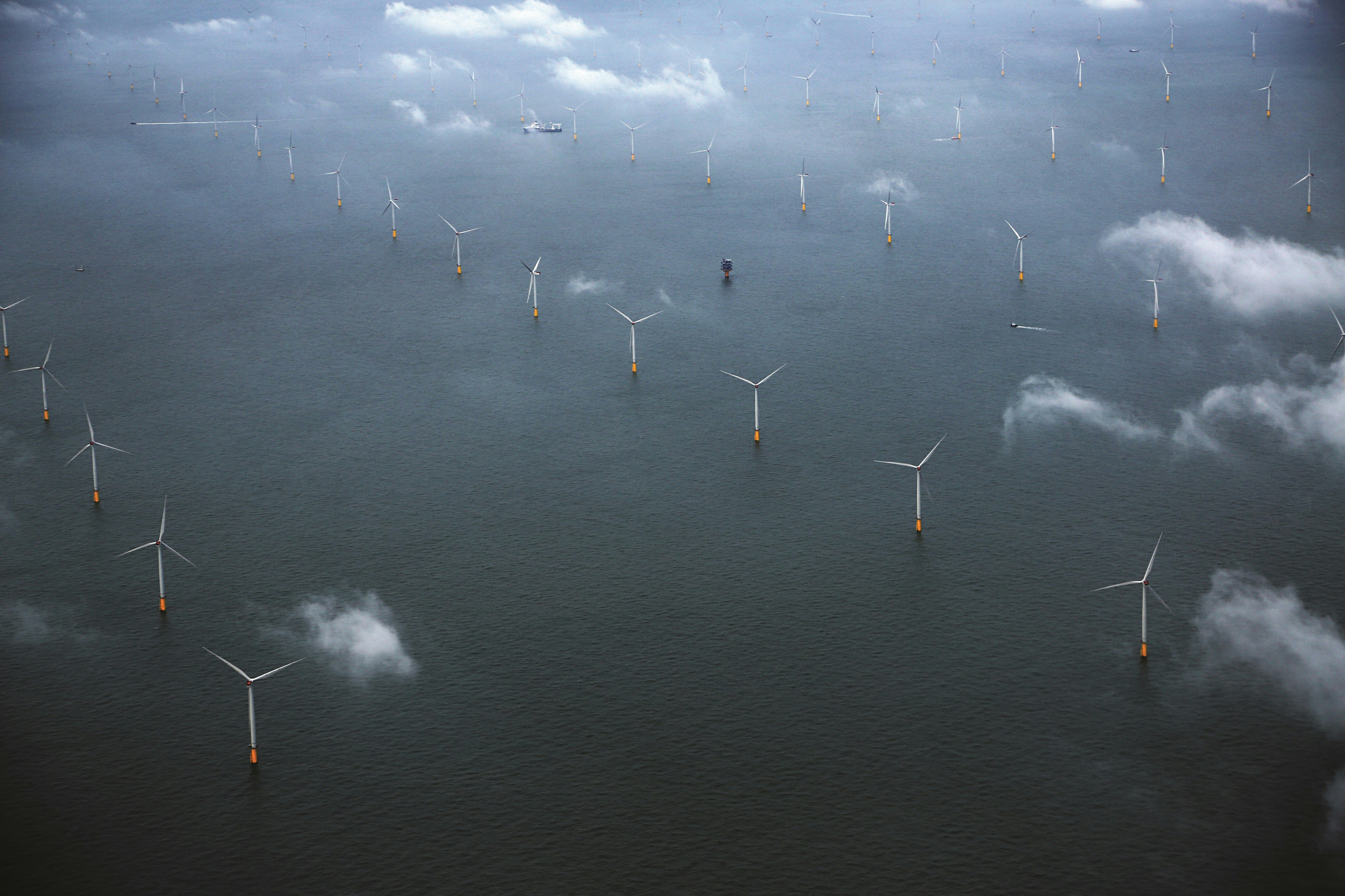
With long coastlines, favourable wind conditions and shallow waters in many areas, the UK offers world-class natural resources for offshore wind.
But the UK seabed is increasingly busy, with demands ranging from cables, pipelines and sand and gravel extraction, to navigation, fisheries and aquaculture. There is also the need to maintain an ecologically coherent network of marine protected areas. Throughout our planning for Round 4, we used data & analysis alongside engagement with a wide range of stakeholders to help strike this careful balance.
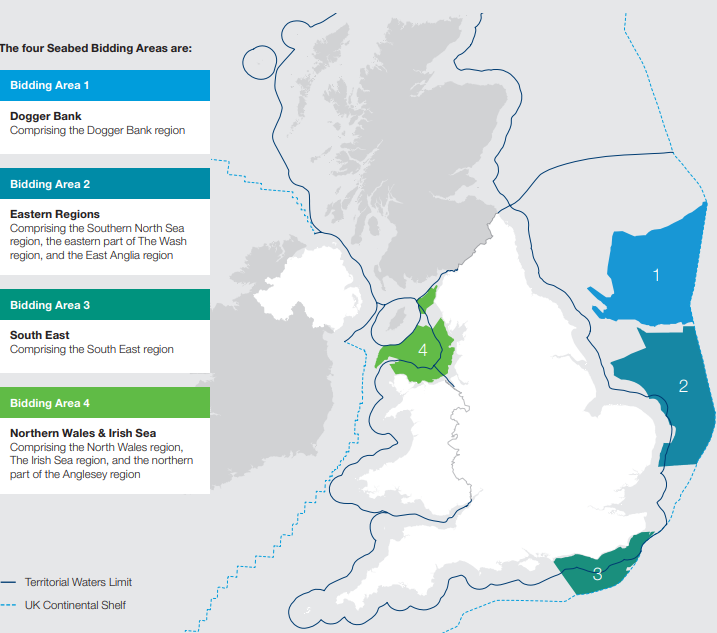
Following extensive spatial analysis and stakeholder engagement, we built a detailed evidence base to help us identify areas of seabed that offer the least constrained (most technically favourable) areas for offshore wind development – refined into four Bidding Areas.
These four Bidding Areas – Dogger Bank, Eastern Regions, South East, and Northern Wales & Irish Sea - are well suited to lower cost, fixed foundation offshore wind turbine technologies, offering the strongest opportunities for development at the current time.
Each area has waters up to 60 metres depth, and is less constrained than other areas by factors including: Ministry of Defence ranges and exercise areas; visual sensitivity within 13 km of shore; overlap with busy shipping routes; and major consenting risk due to cumulative environmental impacts, particularly ornithology.
These areas have been further refined to identify six development areas where Agreements for Lease have now been signed – located off the North Wales, Cumbria and Lancashire coast, and in the North Sea off the Yorkshire and Lincolnshire coast.
You can find the details of this important work in our Resource and Constraints Assessment Methodology Report, Characterisation Areas Reports and Regions Refinement Report in the Round 4 document library.
The four available seabed Bidding Areas for Leasing Round 4 were: Dogger Bank, Eastern Regions, South East, and Northern Wales & Irish Sea.

You can also view a PDF of the seabed Bidding Areas map here.
For GIS shape files of the seabed Bidding Area boundaries, Characterisation Areas, and hard constraints, please visit our Open Data Portal.